
Why is topography needed? Before starting a project
A plot may look flat and empty, but its area alone is not enough to design a project. Changes in elevation, existing structures, roads and other features also matter. A topographic survey measures these conditions and turns them into information a designer can use.
Topography describes terrain and the position of natural and built features. A topographic plan presents measured site information at a defined scale.
What does a topographic plan show?
Depending on the brief, it can include elevations and contours, buildings, roads, fences, visible utility features and survey control. Unlike an ordinary satellite image, a survey plan supplies measured positions and heights in an agreed reference system.
Why is it needed for construction and landscaping?
Existing ground levels influence entrances, access gradients and the assessment of water flow. Ignoring elevation differences can lead to additional earthworks or design changes.
For example, a height difference between a road and a plot must be considered when designing an entrance. Survey data provides the starting information; the drainage solution itself still requires appropriate engineering calculations.
Roads, utilities and earthworks
Measured data supports route design, longitudinal profiles and cross-sections. A digital terrain model can support earthwork volume calculations when its detail and quality suit the task.
Surface surveying does not reveal every underground utility. Existing records, specialist detection and any necessary verification must be considered separately.
What does a 1:500 plan mean?
At 1:500, one centimetre on the plan represents five metres on the ground. This scale may suit detailed site planning, while other scales may be appropriate for larger areas.
Scale is not an automatic accuracy guarantee. Agree the coordinate and height system, accuracy requirements, terrain representation and file formats before work starts.
How is the survey delivered?
After reviewing the site and brief, the team collects, processes and checks measurements. GNSS, total stations, levelling and suitable drone methods may be combined. Agreed outputs can include DWG and PDF plans, coordinate and elevation schedules and a terrain model. Not every project needs every format.
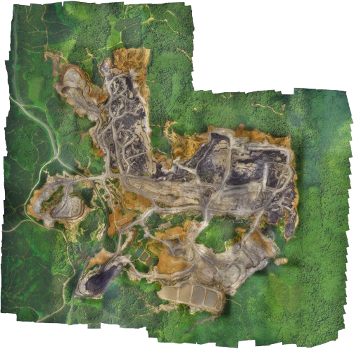
GeoTotal's Hadrut project provides an example of topographic and LiDAR survey applications. Explore our geodesy and topographic surveying services for more information.
Frequently asked questions
Can an old plan be reused?
Check its date, reference system and consistency with current conditions. Construction, excavation or road changes may have made it outdated.
Can drone photographs replace a survey plan?
Photographs alone cannot. Appropriate acquisition, control, processing and accuracy checks are required.
How can I obtain a price and schedule?
Send the location, approximate area, project purpose, existing information and required outputs. Site complexity, access and level of detail affect both cost and duration.
Plan your survey
Agreeing the scope early helps the design team receive usable information. Contact GeoTotal to discuss your site and deliverables.